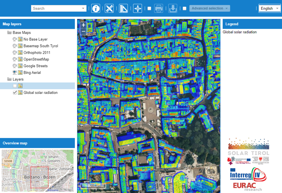
Being involved in the SolarTirol project, which was part of the Interreg IV EUTC Italia-Austria program from 2012 to 2015, I contributed to the development of an interective WebGIS tool for assessing and visualizing solar potential on the rooftops in the Autonomous Province of Bolzano (South Tyrol).
My primary contribution was leveraging my expertise in data analytics and cartography to create a comprehensive WebGIS application tailored for solar cadaster visualization.
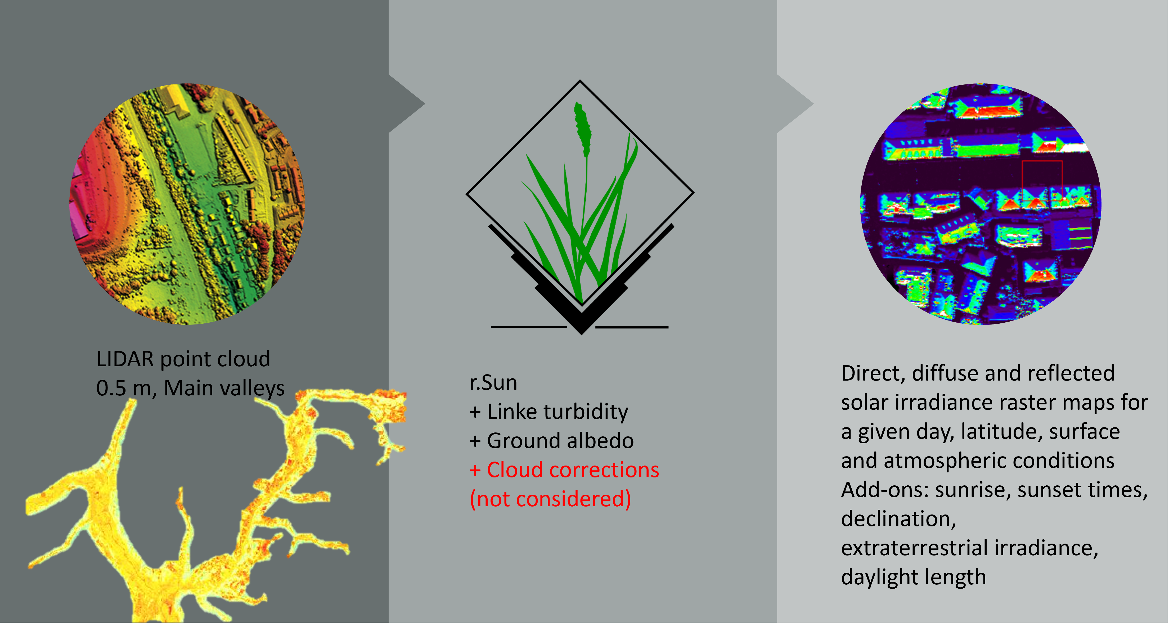
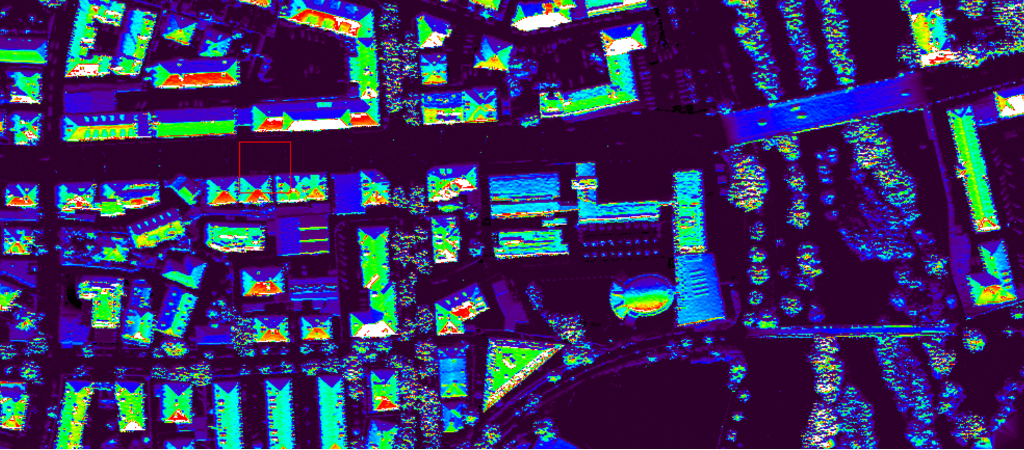
The highlight of my work involved designing and implementing the WebGIS platform to integrate and visualize solar irradiance data effectively. This tool was engineered to provide end-users with intuitive access to complex datasets, enabling them to identify optimal locations for photovoltaic (PV) installations with unprecedented ease and accuracy. By synthesizing geographic and solar energy data, I crafted interactive maps that serve as critical resources for community planning, energy investment decisions, and promoting sustainable development.